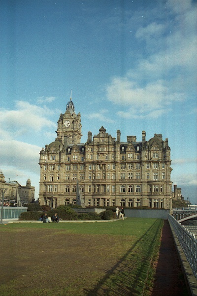
To the left is the Balmoral Hotel, formerly the North British Hotel.
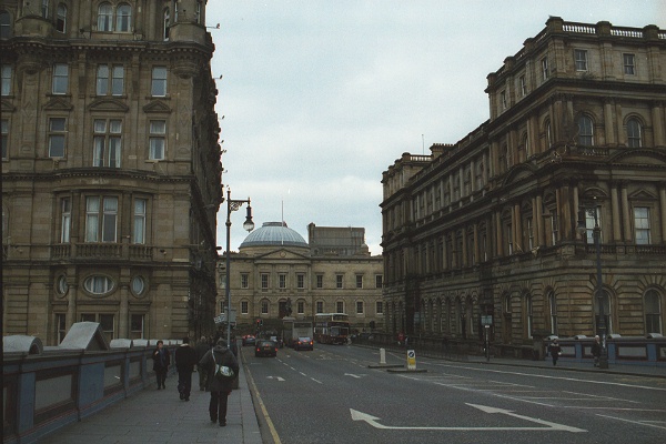
In the middle, with the dome, is Register House
To the right is the old Post Office building.
Underneath the North Bridge is Waverley railway station - both the Hotel and Post Office had their own sidings.

The dirty concrete block behind Register House is part of the St James Centre (see below)


None of these roads are still Primary routes, so the green signs are an anachronism.

The wall to the left, with the false windows, is the wall of the Calton Cemetry.

In theory, the left lane is left turn only, and the right lane is straight on and right, but it's widely ignored.

Notice the lines of white dots on the road to continue the two lanes from the A900 around onto the A7 and A8. (Most drivers don't notice, and cut the corner anyway, turning right onto the A8 from the left lane.)


The building on the right is the east facade of Register House, while on the left is the rear of the buildings on Waterloo Place


Overhead and on the right is the St James Centre (1964-72), a 'megastructural' building comprising shopping centre, hotel, office building, and multi-story car parks. Although the shopping centre and hotel are successful, the office block was vacated within a few short years, and has remained empty ever since.


On the top of the Nelson Memorial (the upturned telescope), is a Time Ball which is dropped every day at 1 PM - just as the gun signal is fired at the castle.


The old Post Office is on the right, A1 Waterloo Place straight ahead, and the Wellington statue on the left.
The road in this direction is only open to buses, bikes, and taxis, so there's no signposting from apart from the small signs at the far side of the junction (pictured above).

The Balmoral Hotel is far left, with the Scott Monument right of centre. Between them, alongside the road are the spikes of the Waverley Market, and behind the silhouette of the castle.


The next building, Waverley Market, from where this photo was taken, is a four-level shopping mall entirely below street level. It's recently been rebranded Princes Mall, but is still widely known as Waverley Market.

The roof is used as a venue for the Edinburgh Fringe, and the grass barely has time to recover between seasons.

To the left, beyond the bridge, is the Governer's House, the only surviving building from the old Calton Gaol. It's now the headquarters for the Scottish Executive's Security Service.

On the south side, the tall buildings are (on either side of the bridge) the Calton Highland Hotel and the Scotsman newspaper offices (now being redeveloped). To the right is the old Fruitmarket (now art galleries). All three buildings had access under Market Street to the railway.

The gardens were originally private gardens for the houses on the north side of Princes Street, but as the buildings were increasingly used for shops and offices, the gardens were landscaped and opened to the public.
The massive bulk of the Scott Monument dominates this part of the gardens. In the distance, sheathed in scaffolding, is the Royal Scottish Academy (an art gallery).
(Most similar gardens elsewhere in Edinburgh's New Towns are mainly still private, with access for keyholders only.)

Westbound, Princes Street is open to all traffic, but includes stretches with a double bus lane and one lane for general traffic. Congestion at the West End junction, in the distance, can tail back right along Princes Street.
Eastbound, Princes Street is only open to buses, bicycles, and (during the night) taxis. The carriageway has been narrowed down to two lanes to provide additional pavement width.

